

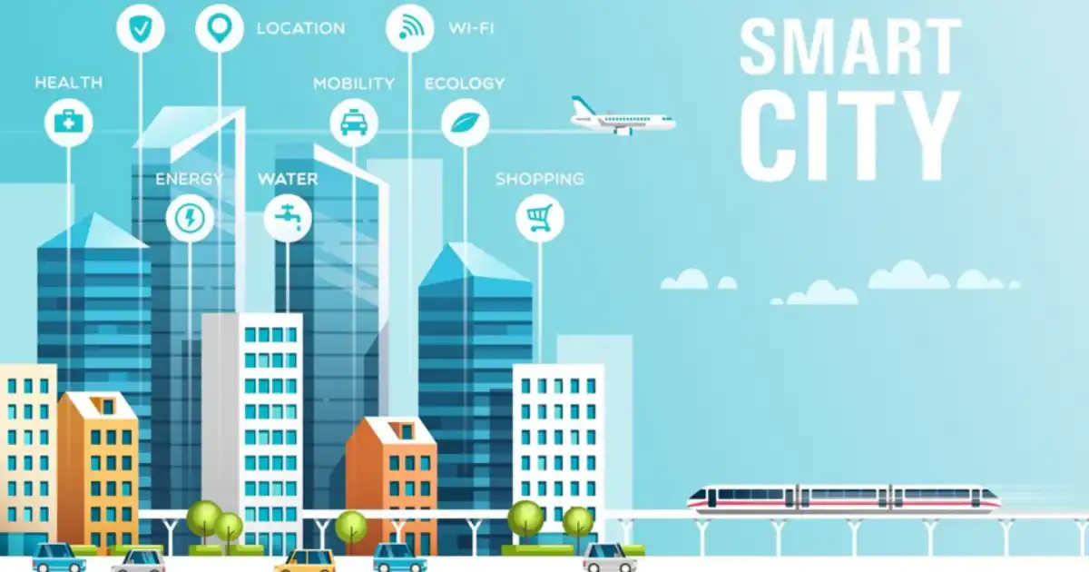
Imagine a city where floods, wildfires, earthquakes—and even human-caused emergencies—can be detected early, managed proactively, and responded to with pinpoint precision. A city where massive damage, loss of life and infrastructure collapse are sharply reduced because systems are watching, analysing, communicating—before a disaster turns into a catastrophe. This is not science-fiction: we are entering the era of the AI Smart City, and its promise is particularly powerful in the realm of disaster response planning.
In this guide you will discover how AI Smart City tools are reshaping how we prepare for, react to and recover from disasters. You’ll learn what these tools are, why they matter, how they work, and crucially—how you or your city might implement them. If you care about safety, resilience, urban planning or simply want to understand the next frontier of technology + humanitarian action—then read on.
Cities around the world face growing risks: climate change increases flooding and storms, urbanisation creates densely populated vulnerable zones, ageing infrastructure fails, human crises escalate. The good news? The convergence of artificial intelligence (AI), Internet of Things (IoT), big data, sensor networks and advanced communications means that we can build smarter cities that aren’t just reactive—but anticipatory. This is the promise of an AI Smart City applied to disaster response planning.
For cities that adopt these tools, the benefits are tremendous: faster response, fewer lives lost, less economic damage, and greater community resilience. For citizens it means safer neighborhoods and more peace of mind. For planners and policymakers it means more effective use of limited resources. It is this transformation—of cities becoming resilient, responsive, intelligent—that makes the topic so compelling.
What is an AI Smart City in the context of disaster response?
In simplest terms, an AI Smart City is a city that uses advanced technologies—sensors, data networks, AI algorithms, digital platforms—to monitor, analyse and optimise urban systems. When we apply this to disaster response planning, it means the city is prepared to use these technologies not just for everyday operations (traffic, energy, utilities) but to anticipate, respond to, and recover from disasters.
Core elements
Some of the key components of such a system include:
-
IoT sensors and devices that continuously monitor environmental, structural and human-movement data.
-
GIS (Geographic Information Systems) and mapping tools to visualise hazard zones, vulnerable infrastructure, evacuation routes.
-
AI and machine learning (ML) algorithms to analyse large datasets, detect patterns, forecast hazards and optimise resource allocation.
-
Communication networks (including 5G, edge computing hubs) to rapidly disseminate alerts and coordinate response.
-
Digital twins or simulation environments – virtual replicas of the urban environment where scenarios can be tested.
-
Citizen engagement platforms and crowdsourcing tools so that residents contribute data and receive alerts.
Disaster-response cycle in a Smart City
When applied to disaster response planning, an AI Smart City approach covers three broad phases:
-
Preparedness / mitigation identifying risk zones, monitoring build-up, pre-positioning resources.
-
Response / operational real-time monitoring during an event, dispatching assets, evacuation management, coordination.
-
Recovery / learning post-event assessment, damage analysis, feedback loops to improve systems.
In all phases, the key is data-driven decision-making, connectivity, automation and collaboration across agencies and citizens.
Why AI Smart City tools matter for disaster response planning
Let’s review the reasons why these tools are crucial, especially in modern cities.
Increasing disaster risk
Urbanisation and climate change are raising disaster risks. More people live in dense cities, infrastructure ages, weather extremes become more frequent. According to experts, smart city technologies are becoming vital for resilience.
Early detection and prediction
Traditionally, many disasters strike with little warning. Using sensors and AI, cities can detect subtle signals (rising water levels, abnormal structural vibrations, unexpected movement) and predict hazards before they fully develop. For example, AI-powered sensors detect flood or wildfire threats quicker than manual systems.
Faster and smarter response
When a disaster hits, response speed and accuracy are vital. AI Smart City tools assist by:
-
Prioritising which areas need attention.
-
Dispatching responders based on predicted worst-hit zones.
-
Using real-time mapping to coordinate evacuation and relief.
For example, one study noted how AI and computing platforms improved response systems and infrastructure monitoring.
Resource optimisation
Cities have limited budgets and resources. Smart systems help allocate resources where they’re most needed—fire trucks, medical teams, temporary shelters—all guided by predictive analytics and live data. The earlier you allocate resources, the less damage you incur, and that means lower economic loss.
Improved community resilience
Beyond just responding, these tools help build resilience. Citizens receive timely alerts, can contribute via crowdsourcing platforms, and become part of the loop. The city gains better situational awareness via citizen-data. For example, AI-enhanced crowdsourcing improves information collection and decision-making. Central
Data-driven learning and adaptation
After a disaster, smart city systems feed back information into models—what worked, what didn’t, what needs improvement. This means each incident becomes a source of learning and the city becomes smarter. Research shows that advanced frameworks help integrate into existing systems to accelerate learning.
In summary: adopting AI Smart City tools for disaster response is no longer optional—it’s rapidly becoming essential if cities want to maintain safety, resilience and operational efficiency in the face of rising threats.
Key AI Smart City Tools & Technologies for Disaster Response
In this section we’ll explore several specific tools or technological areas within the AI Smart City ecosystem, and how they apply to disaster response planning.
IoT Sensors & Real-Time Monitoring
Sensors embedded in urban infrastructure continuously monitor conditions: water levels, river flows, soil moisture, structural vibrations, building tilt, temperature changes, smoke/fire detection, crowd density, traffic flows. These sensors feed data into the system, enabling real-time awareness.
A sub-category: AI-powered sensors – sensors with embedded intelligence (edge computing) that analyse data locally and send alerts when anomalies occur. For example: “AI-Powered Sensors for Disaster Preparedness in Smart Cities” describes how they work for floods, wildfires, earthquakes.
Geographic Information Systems (GIS) & Mapping
Mapping hazard zones, infrastructure vulnerability, evacuation routes, shelters, resource locations is foundational. GIS integrates spatial data with sensor data and AI models so planners can visualise risk in the urban geography.
During a disaster, GIS can show live updates: which roads are blocked, which areas cut off, where shelters are full, etc. This helps response teams reroute, reorganise and allocate resources dynamically.
AI & Machine Learning Analytics
This is the heart of the system: taking massive volumes of data—from sensors, satellites, social media, infrastructure logs—and using AI/ML to detect patterns, forecast hazards, optimise responses.
Some example uses:
-
Predicting flood risk zones based on rainfall, terrain, soil moisture.
-
Analysing earthquake sensor data to identify vulnerable bridges/buildings.
-
Monitoring social media posts to identify emerging crisis signals (crowd panic, structural collapse) in real time.
Digital Twins & Simulation Environments
A digital twin is a virtual replica of the city (or city subsystem) that mirrors reality in real time. Governments and planners can simulate disasters: how wildfires spread, what happens if a bridge collapses, evacuation flow during a major earthquake. This enables scenario planning, training, decision-making.
This tool is especially useful in disaster response planning: you can test “what if” scenarios, train staff, identify weak points, fine-tune response protocols.
Communication Networks & Citizen Platforms
In a disaster, communication lines can fail or become crowded. But in an AI Smart City environment:
-
Automated alert systems can send messages to citizens via app, SMS, social media.
-
Two-way platforms allow residents to report issues (damage, blocked roads, injured persons) which feed back to the system.
-
AI-enabled crowdsourcing tools process citizen reports to provide situational awareness.
Communication is critical: a system is only as good as its ability to reach people and coordinate action.
Edge Computing & High-Speed Networks
With vast amounts of data and the need for real-time response, data processing at the edge (near the data source) becomes important. Smart city systems incorporate edge computing, 5G/6G networks, low-latency connectivity so alerts and decisions happen swiftly.
Autonomous Systems: Drones, Robots, Satellite Imagery
Backup systems when ground access is impossible:
-
Drones equipped with cameras/thermal sensors + AI computer vision to assess damage, locate survivors.
-
Satellites feeding imagery for large-scale disasters to map damage and AI to analyse changes.
These autonomous systems extend the reach of response teams, often in dangerous or inaccessible zones.
Crowdsourcing & Social Media Analytics
Integrating citizen input and social media data adds a crucial dimension: public-facing real-time information. AI systems monitor posts, images, videos to detect emerging issues faster than some official channels. For example: “AI-enhanced crowdsourcing for disaster management” shows improved demand recognition and synchronised responses.
Stages of Disaster Response Planning with AI Smart City Tools
Now we’ll trace the lifecycle of disaster response planning in a city using these tools—from preparation to recovery.
Preparedness & Mitigation
In this stage the city builds capability so when disaster strikes, it’s ready. Key activities:
-
Risk Assessment
Use historical data, hazard modelling and GIS to map high-risk zones (floodplains, seismic fault lines, infrastructure weakness). AI helps by analysing large datasets and identifying subtle vulnerabilities.
-
Sensor Deployment
Strategically placing IoT devices in vulnerable spots (riverbanks, tunnels, bridges, high-risk buildings) so continuous monitoring begins.
-
Digital Twin Simulation
Planners simulate disaster scenarios: “What if an earthquake of magnitude 7 hits this district?” or “What if river overflow occurs during monsoon?” They test evacuation routes, resource plans, staffing, communication failures.
-
Resource Pre-Positioning
Based on risk maps and simulation outcomes, the city pre-positions supplies, shelters, medical facilities, rescue teams in optimal locations.
-
Community Engagement and Training
The city engages citizens via alert apps, educational programs, drills. Crowdsourcing platforms allow residents to report early signs of trouble and help build a culture of preparedness.
-
Integration of Systems
Combining sensor networks, data platforms, AI analytics, communication systems into a unified “one-city” command network.
With these systems in place a city transitions from just reacting to disasters to being proactive—anticipating and reducing risks before they escalate.
Response (During a Disaster)
When a disaster occurs, time is of the essence and coordination is critical. Here’s how AI Smart City tools shine:
-
Real-Time Monitoring
Sensors and drones feed live data into command centres. AI analyzes the streams, detects anomalies (e.g., rising water levels, structural cracks) and flags threats.
-
Live Mapping & Decision Support
GIS dashboards show responders the state of infrastructure, blocked roads, safe evacuation zones, shelter capacity. AI suggests optimal routing and resource deployment.
-
Alerting Citizens
Automated systems send instructions to residents: evacuation orders, safe routes, shelter availability, status updates. Two-way communication allows citizens to report back (trapped people, damage, needs).
-
Resource Allocation & Dispatch
AI models, based on incoming data, suggest where to send the next ambulance, fire crew or relief truck. It can prioritise based on severity, accessibility, population density.
-
Drones/Robots for Assessment
In places not reachable by ground, drones fly in, capture imagery, feed to AI vision systems that quickly assess damage, find survivors, locate hazards like gas leaks.
-
Crowdsourced Intelligence
Social media posts, citizen reports are analysed via AI to identify new hotspots, people needing help, or infrastructure failures.
During the response phase, the city’s digital backbone becomes active: data flows from sensors, citizens, drones into AI engines that provide decision-support, routes, prioritisation. This significantly increases speed and efficiency compared to traditional manual response.
Recovery & Learning
After the immediate crisis is over, the work continues: rebuilding, assessing, learning. AI Smart City tools contribute here too:
-
Damage Assessment
Satellite images, drone footage, sensor logs are fed into AI models that estimate damage across buildings, roads, utilities. This speeds insurance, aid distribution, reconstruction planning. Earth.org
-
Infrastructure Monitoring
Post-disaster, sensors continue to monitor repaired structures, so any latent damage or risk becomes visible early on.
-
Performance Analytics
The city’s response data (how fast resources moved, which routes got blocked, citizen compliance) is analysed by AI to identify what worked and what didn’t.
-
Updating Models & Plans
Based on post-event data, simulation models are adjusted, resources re-allocated and future preparedness is improved.
-
Community Feedback & Engagement
Citizen platforms collect feedback on shelter effectiveness, communication clarity, and local knowledge is integrated into plans.
Recovery is a critical phase for resilience: it’s where the city learns and improves. Without this, disasters repeat with similar consequences. The “smart” part of AI Smart City is in continuous improvement.
Real-World Examples & Case Studies
Here are a few concrete examples of how cities and technology companies have applied AI Smart City tools for disaster response planning.
The use of sensors for flood and wildfire detection
According to an article “AI-Powered Sensors for Disaster Preparedness in Smart Cities”, AI-driven sensors have been deployed to identify threats like floods, wildfires and earthquakes more quickly and accurately than older systems.
In one example, flood-monitoring sensors detected rising water levels one hour ahead of traditional systems—giving precious time for evacuation.
GIS + AI for hazard and infrastructure mapping
The article “AI-Powered Tools Are Guiding Disaster Risk Reduction Investments Through AI-Powered Tools” notes that satellite imagery combined with AI today allows mapping of hazards, exposures and vulnerabilities in cities—enabling targeted investments and planning.
This is crucial in regions where budgets are tight: knowing which infrastructure to reinforce, which zones to evacuate first.
Digital twins, simulation & infrastructure resilience
A case study of technology by NVIDIA shows how their platform (Jetson AGX Orin, Omniverse) is being used in smart cities for emergency response, flood monitoring, infrastructure resilience planning.
Cities that build digital twins can simulate disasters before they strike and test responses in a safe environment.
AI-enhanced crowdsourcing for real-time situational awareness
In “AI-enhanced crowdsourcing for disaster management” the authors show how analysing social media posts and citizen-reports via AI provides immediate situational awareness and faster demand recognition during emergencies.
In one instance (in Pakistan) AI systems processed posts, photos and videos to identify hotspots and required aid faster than traditional channels.
These examples illustrate that the tools are not just theoretical—they are being applied today, in real cities, for real disasters. And their impact is accelerating.
Challenges & How to Overcome Them
While the promise is large, implementing AI Smart City tools for disaster response planning is not without difficulty. Here are major challenges and how they can be addressed.
High cost of implementation
Deploying sensors, AI platforms, communication networks and training staff requires significant investment. Many cities especially in developing countries struggle with budgets.
Start with pilot programmes in high-risk zones, seek public-private partnerships, reuse existing infrastructure (e.g., CCTV networks), international grants for disaster resilience.
Data privacy, security and trust
Collecting and analysing large volumes of citizen, sensor and infrastructure data raises concerns about privacy, misuse and cyber-threats.
Develop clear data governance frameworks, anonymise citizen data, engage communities with transparency, build robust cybersecurity into system design.
Interoperability and legacy systems
Cities often have existing systems that don’t easily integrate with new platforms; sensors from different vendors, fragmented data silos.
Adopt standards for data formats, engage vendors with open APIs, gradually phase in integration, ensure system flexibility and scalability.
Skill-gap and maintenance
Operating AI tools, sensor networks and communications systems requires technical skills which may be scarce in many municipalities. Also, systems need continual maintenance and updates.
Invest in training programmes, collaborations with universities and tech firms, build local capacity, budget for ongoing operational costs not just initial deployment.
Equity and inclusivity
Smart city systems may inadvertently exclude vulnerable populations who lack smartphones or access, or may bias models based on incomplete data.
Ensure citizen engagement covers all communities, deploy multi-channel alert systems (more than apps), explicitly design for inclusion and accessibility.
Over-reliance on technology
Technology can fail (power outages, cyber-attack, communication breakdown). Over-reliance without back-ups can be risky.
Maintain manual response pathways, train human teams regularly, build redundancy into systems, run drills simulating system failures.
Step-by-Step Guide to Implementing AI Smart City Tools for Disaster Response Planning
Now let’s lay out a structured roadmap that a city or region might follow to implement such systems, using best practice from the research and the examples above.
Step 1: Conduct a Risk & Needs Assessment
-
Map out the types of disasters the city is most vulnerable to (floods, earthquakes, fires, infrastructure collapse, human-caused).
-
Use historical data, climate models, urban growth projections, stakeholder interviews.
-
Identify critical infrastructure and vulnerable zones (hospitals, schools, bridges, slums).
-
Determine current response capability, gaps, timeline, and budget constraints.
Step 2: Define Vision, Goals & Stakeholders
-
Set clear objectives: e.g., reduce disaster response time by 30 %, increase early warnings, optimise resource allocation.
-
Identify lead agencies (municipal disaster management, ICT, utilities, police/EMS).
-
Engage stakeholders: private tech firms, universities, citizen groups, NGOs, insurers.
-
Create governance structure, define roles/responsibilities.
Step 3: Select Technologies & Platforms
-
Based on the risk assessment, select which tools make sense: sensors (flood, structural, seismic), GIS mapping, AI analytics, drones, citizen apps.
-
Choose vendors/partners with open standards and integration capability.
-
Plan for connectivity (5G/edge, IoT networks), data storage, cloud versus on-premises.
Step 4: Pilot the System
-
Choose a manageable zone/corridor within the city (e.g., flood-prone riverbank area) for a pilot.
-
Deploy sensors, integrate with GIS, set up AI analytics, citizen reporting app.
-
Run simulation drills: – Flood scenario – Earthquake event – Mass evacuation – Infrastructure collapse
-
Measure performance: detection speed, alert dissemination time, resource dispatch time, citizen compliance.
Step 5: Scale Up & Integrate City-Wide
-
Based on pilot results, refine the system: fix issues, adjust models, improve user interface, train teams.
-
Expand coverage to entire city: from pilot zone to other high-risk zones.
-
Integrate with other city systems: traffic management, utilities, health services, emergency operations centre (EOC).
Step 6: Monitor, Evaluate & Improve
-
After full deployment, continuously monitor key performance indicators (KPIs): detection accuracy, response times, resource utilisation, citizen satisfaction.
-
Analyse data after real events: what worked, what didn’t. Use AI analytics for learning.
-
Update models, simulations, sensor placements, communication channels based on feedback.
-
Maintain training and drills for staff and citizens regularly.
Step 7: Engage Community & Maintain Trust
-
Launch public education campaigns: how the system works, what citizens can do, how to receive alerts, how to report issues.
-
Provide transparent reports on system performance and data privacy.
-
Encourage citizen participation: apps for reporting hazards, workshops on preparedness.
-
Ensure inclusivity: multi-language alerts, multiple channels (SMS, radio, mobile app, social media), accessible for persons with disabilities.
Step 8: Sustainability & Funding
-
Secure ongoing funding for maintenance, upgrades, training—not just one-time purchase.
-
Explore public-private partnerships, grants from international bodies (UN, World Bank), insurance incentives.
-
Evaluate cost-benefit: savings from avoided disasters, reduced economic loss.
The Future of AI Smart City Tools in Disaster Response Planning
Looking ahead, there are several emerging trends that will shape the next generation of AI Smart City disaster-response systems:
-
Edge AI and on-device processing
More data processed at edge devices (sensors) for faster local decisions and less reliance on central servers.
-
Digital twins of entire cities
More detailed virtual models that reflect real-time conditions and integrate citizen behaviour, infrastructure, climate modelling.
-
Greater autonomy
Drones and robots will carry out search & rescue, inspections, supply drops with minimal human intervention.
-
Advanced geospatial AI
Models like “RoadMind” are enhancing spatial reasoning for disaster response, e.g., determining best evacuation routes using road network data.
-
Integration with climate-change adaptation
As weather extremes intensify, smart-city disaster tools will converge with sustainability and climate resilience initiatives.
-
Citizen-centric platforms
More apps, public dashboards, gamified drills, digital citizen participation in real time.
-
Global collaboration and data sharing
Cities sharing best practices, data standards, cross-border disaster planning.
Thus, the concept of an AI Smart City isn’t static; it evolves as technology advances, data accumulates, and threats change. For planners and citizens alike, staying adaptable is key.
You Might Be Interested In
- What Is Machine Learning In Public Policy?
- What Is Machine Learning Algorithms?
- What Is A Saas Platform?
- Top 10 Ai-powered Chatbots For Government
- 7 Ai Tools Helping Small Businesses Outcompete Giants
- Why Machine Learning For Threat Detection Works?
- Where To Find Ai News Without Hype Sources?
- 5 Best AI Copywriting Tools for 2023 (Not ChatGPT)
- How Do Ai Automation Tools Improve Workflows?
- Top 7 Nations Building Ai-optimized 6g Networks
Conclusion
In this comprehensive guide we’ve explored how AI Smart City tools are transforming disaster response planning. We began with the idea of a city that doesn’t just wait for disaster—but anticipates it, mitigates it, responds to it, learns from it. We defined the core elements of such systems: sensors, GIS, AI analytics, digital twins, communication platforms, citizen engagement. We saw how these tools matter: faster detection, smarter resource allocation, improved resilience, community empowerment. We surveyed specific technologies and their roles. We walked through the disaster lifecycle—preparedness, response, recovery—and mapped the role of AI Smart City tools at each stage. We examined realworld examples of how sensors, mapping, simulation and crowdsourcing are already in play. We looked frankly at the challenges—cost, data governance, interoperability, skills—and offered best practices to overcome them. We described a practical step-by-step implementation roadmap. We highlighted special considerations for developing regions—and glimpsed ahead to the future of this field.
The core takeaway: disaster risk is rising, but so are the tools to manage it. Building an AI Smart City for disaster response isn’t just about fancy technology—it’s about integrating data, systems, people and plans in a cohesive way. It’s about aligning vision, investment, training and community. It’s about moving from reactive to proactive, from guesswork to data-driven decisions, from individual silos to integrated operations.
If you are a city official, emergency planner, urban technologist or simply a citizen interested in resilience: start conversations today. Map the risks in your area. Engage your community. Explore pilot projects. Seek partnerships. Because the sooner a city deploys its smart tools, the greater its ability to save lives, preserve infrastructure and maintain stability when disaster strikes.
In one sense, every city can become a smart city in the face of disaster—but only if it chooses to act. Use this guide as your foundation. The future of safe, resilient, responsive cities depends on it.
FAQs about Ai Smart City
How do smart cities respond to disaster?
Smart cities respond to disasters by using advanced technologies like sensors, data analytics, and artificial intelligence to predict, monitor, and manage crises in real time. These cities are equipped with interconnected systems that continuously collect data from various sources—such as weather stations, surveillance cameras, and IoT devices—to detect early warning signs of disasters like floods, earthquakes, or fires. Once potential risks are identified, automated alerts are sent to emergency services and citizens through apps, public displays, and mobile notifications.
During and after a disaster, smart cities coordinate responses through centralized control centers that help emergency teams make faster, data-driven decisions. For example, traffic management systems can clear routes for ambulances, while drones can assess damage in unsafe areas. This integration of digital infrastructure ensures resources are used efficiently, helps reduce casualties, and speeds up recovery efforts, making cities more resilient and adaptive in times of crisis.
How can AI be used in smart cities?
AI plays a vital role in making smart cities more efficient, safe, and sustainable. It helps analyze the vast amount of data generated daily—from traffic patterns and energy usage to public safety reports and environmental conditions. With AI, city management systems can make predictions and automate decisions that improve urban life. For instance, AI can optimize traffic lights to reduce congestion, manage energy grids for better power distribution, and even detect crimes or accidents using smart surveillance cameras.
In emergencies, AI enhances communication between departments, prioritizes resource allocation, and assists in forecasting risks like air pollution or flooding. Beyond disaster response, AI supports long-term planning by identifying trends in population growth, waste management, and infrastructure needs. Essentially, it acts as the “brain” of a smart city, turning raw data into actionable insights that make cities more livable, efficient, and secure for everyone.
What is the AI based emergency response system?
An AI-based emergency response system is a technology-driven platform that uses artificial intelligence to detect, assess, and respond to emergencies faster and more effectively than traditional systems. It integrates data from various sources—such as weather satellites, CCTV footage, social media posts, and emergency calls—to identify early signs of disasters or crises. Once detected, AI algorithms analyze the situation to determine the severity, affected areas, and the best response strategies.
These systems can automatically alert emergency responders, dispatch resources, and provide real-time updates to both authorities and citizens. For example, AI can predict the spread of wildfires, identify blocked roads during floods, or even pinpoint people trapped under debris using drones and sensors. By minimizing human error and improving decision-making speed, AI-based emergency systems save lives and reduce damage during critical events.
How can AI-powered robots enhance disaster response?
AI-powered robots can transform disaster response by performing dangerous, time-consuming, or physically demanding tasks that are unsafe for humans. During events like earthquakes, building collapses, or chemical leaks, these robots can navigate through debris, detect survivors, and deliver essential supplies. Equipped with cameras, sensors, and mapping tools, they provide rescuers with accurate, real-time information about the situation on the ground—often reaching places humans cannot.
In addition to search and rescue missions, AI robots can assess structural damage, detect hazardous materials, and even repair critical infrastructure components. Drones, for example, can survey large disaster zones from the air, while robotic dogs or crawlers can explore tight spaces. Their precision, speed, and ability to operate without fatigue make them invaluable tools in modern disaster management, improving both the safety and effectiveness of emergency operations.
How is AI used in disaster response?
AI is used in disaster response to predict, detect, and manage emergencies more effectively. It processes massive amounts of data from weather models, satellites, social media, and IoT sensors to forecast potential disasters before they occur. For example, AI can analyze weather trends to predict hurricanes, floods, or landslides, giving authorities time to prepare and evacuate citizens if needed. During an ongoing disaster, AI systems provide real-time updates and suggest optimal evacuation routes, resource distribution plans, and communication strategies.
After the disaster, AI continues to play a role by helping assess damage through image recognition and satellite data, coordinating recovery operations, and even analyzing the effectiveness of the response for future improvement. From early warning to post-disaster recovery, AI enhances every stage of crisis management—making disaster response faster, more precise, and more resilient to future risks.
